

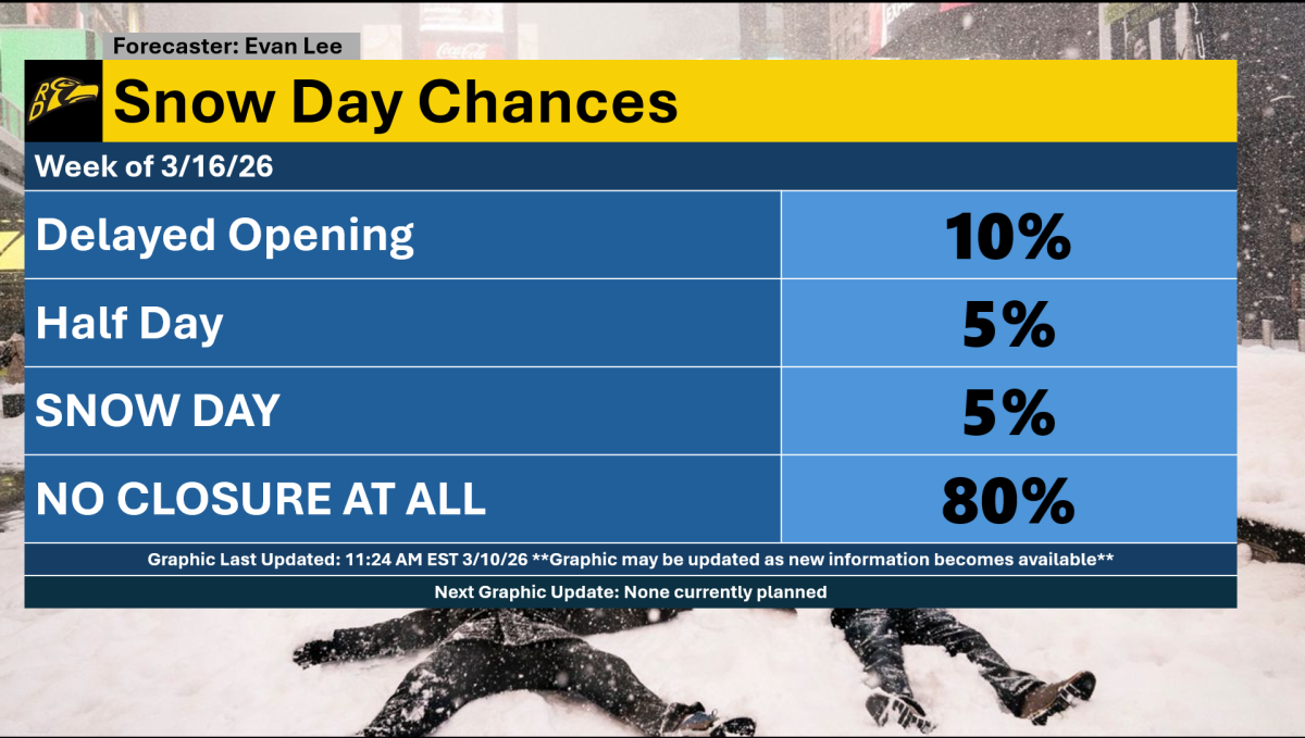


An unsettled weather pattern will set the stage for multiple weak low-pressure systems to impact the area during the week of 3/16/26. While rumors of a snowstorm have circulated, the chances of a blockbuster storm have diminished. However, a light snow event still can’t be ruled out, especially around Monday into Tuesday.
The main event of the week will likely be Monday, as a strong cold front moves through, bringing the potential for rain and perhaps even thunderstorm activity. Any chance of snow would occur on the back side of the front late Monday into Tuesday.
Behind this cold front, Arctic air from Canada will make its way into the Northeastern United States, allowing below-average temperatures in the 20s and 30s to resurface.
High pressure should help suppress any major storm activity for the remainder of the week. However, a weak Alberta clipper cannot be ruled out Wednesday or Friday, which could spark a stray rain or snow shower.
Overall, the threat of a snow day next week is pretty low, especially because a blockbuster storm has basically been taken off the table. That being said, a 5% chance of a snow day or half day has been kept, along with a 10% chance of a delayed opening. For any of these scenarios to happen, the Monday cold front would likely need to be stronger than currently forecast.
Cold air will also return after Monday, with temperatures in the 20s to 30s and occasionally touching the 40s. This aligns with the outlook from the Climate Prediction Center, which predicts below-average temperatures for next week.
The weather is always changing, so stay up to date at the National Weather Service website: weather.gov/nyc on computer or beta.weather.gov on phone.